search
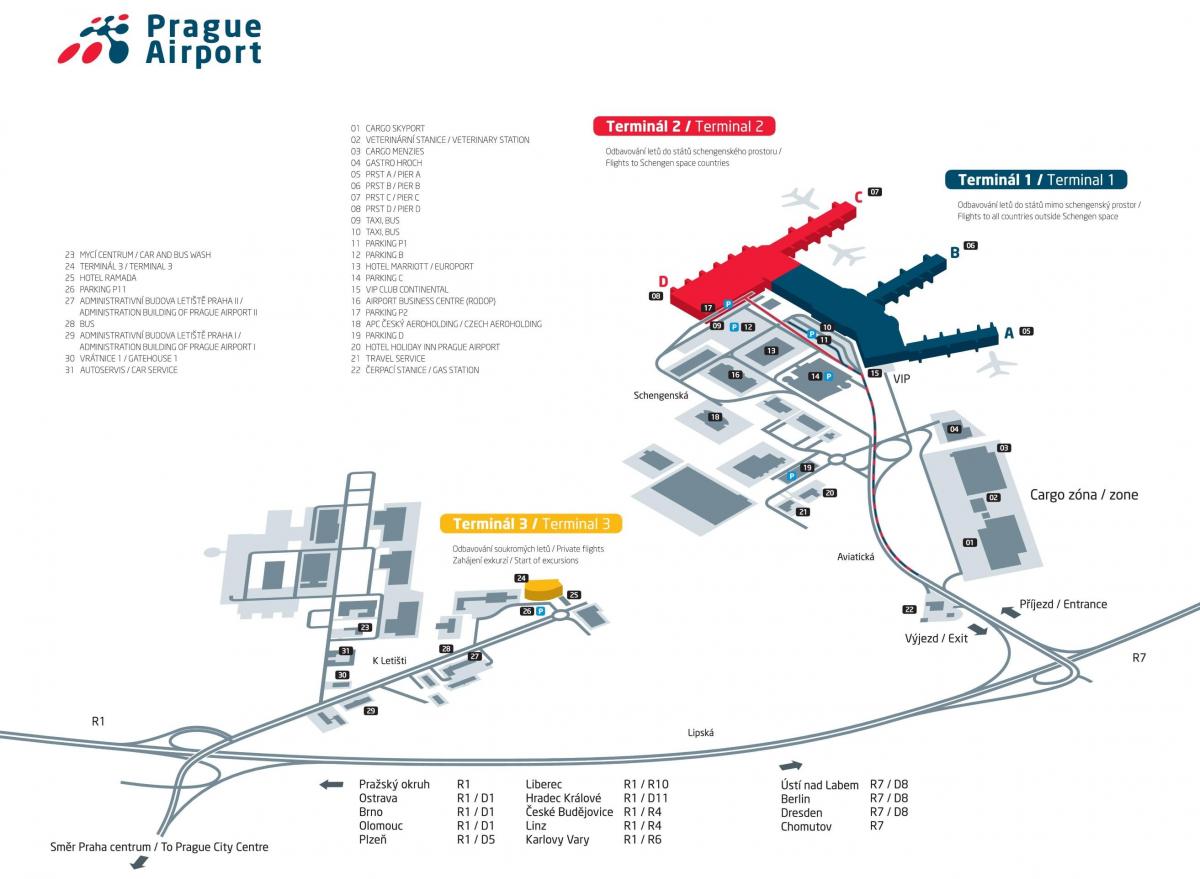
Prague airport map
Prague airport terminal map. Prague airport map (Bohemia - Czechia) to print. Prague airport map (Bohemia - Czechia) to download. Prague airport (PRG) is the largest airport in the Czech Republic map. In 2017, more than 15 million visitors passed through prague airport three terminals. If you arrive at the prague airport sufficiently in advance, you will find a small museum with pictures and videos about the history of the airport inside Terminal 2. You will also be able to see a replica of the cockpit of an airplane.
Prague Vaclav Havel Airport (IATA: PRG; ICAO: LKPR), is the main international airport serving Prague, the largest city and capital of the Czech Republic. Prague Airport is located in Ruzyně map, close to Kezeves village, 12 km (7 miles) west from downtown Prague and 12 km (7 miles) southeast of Kladno. It operates as a hub for Czech Airlines and Smartwings. Prague International Airport consists of a couple of passenger terminals: Terminal 1: For non-Schengen flights. Terminal 2: For Schengen flights. Terminal 3: For VIP, charter, state and private flights.
The history of the prague airport dates back to 1929, when the proposal of the then Czechoslovak government on the construction of a new airport was adopted. The construction of the prague airport started in July 1932 in Ruzyne map with minimal use of machines so that the construction could help to reduce unemployment during the crisis. The construction of prague airport was completed on 1 March 1937 and the airport was immediately described by foreign experts as one of the largest in Europe.


