search
Prague center map
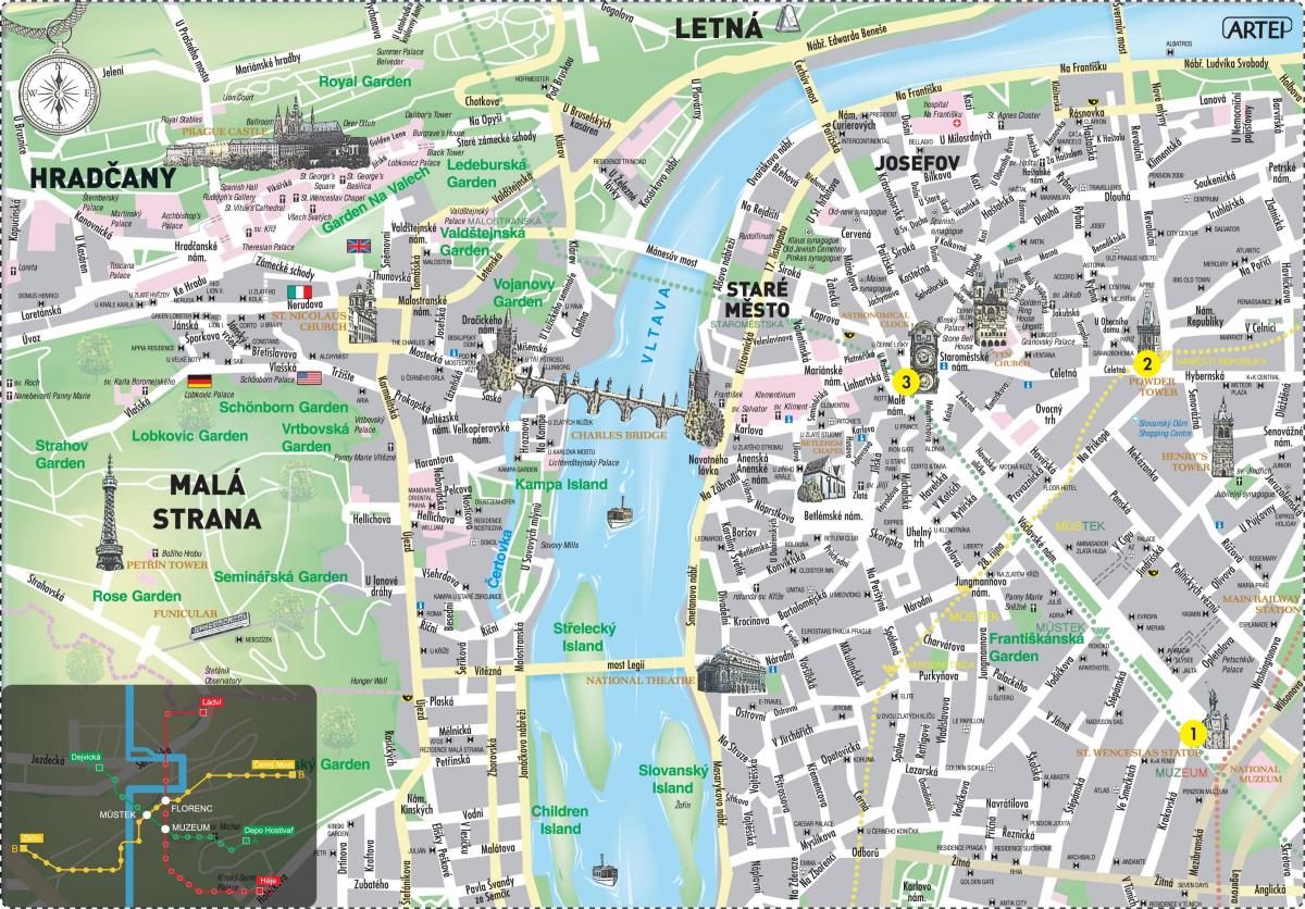
Map of prague city centre in english. Prague center map (Bohemia - Czechia) to print. Prague center map (Bohemia - Czechia) to download. The city centre in prague center map is compact and the finest areas are mostly pedestrianised, so Prague center is best explored on foot; from Wenceslas Square on one side of the city to Prague Castle on the other is just a 30-minute stroll (walking via the Old Town, across the river and through the Lesser Town). A sightseeing tour led by a local guide can provide a good introduction to the city, as they will be able to explain the history and significance of the sights and attractions. But equally, allow time in your schedule to do your own exploring.
The city centre in prague center map is divided into five areas, which span both banks of the Vltava River. On one side of the prague river: the New Town (Nové Město), with Wenceslas Square at its heart; the Old Town (Staré Město), with the Old Town Square at its heart; and the Jewish Quarter (Josefov). Across the water: the Lesser Town (Malá Strana); and above this the Castle District (Hradčany), which is the area around Prague Castle. Charles Bridge is the main pedestrian route linking the two sides of Prague.
The Vltava River flows through the center of prague map, and is the waterway around which the city has developed over the past 1000 years. The Old Town and the New Town lie on one side of the Vltava River. On the other bank is the Lesser Town and Prague Castle, which is a magnificent sight from the water. Spanning the two sides, in the heart of Prague, is Charles Bridge, a pedestrian crossing and focal point for visitors to Prague.


