
search
Prague metro map
Prag metro map. Prague metro map (Bohemia - Czechia) to print. Prague metro map (Bohemia - Czechia) to download. The Prague Metro map shows the different metro lines in Prague. The Prague metro network is divided into three main lines, each of the subway lines is represented by its own color: - Line "A" of the Prague metro: green - Line "B" of the Prague metro: yellow - Line "C" of the Prague metro: red The Prague Metro runs daily between 5:00 am and midnight.
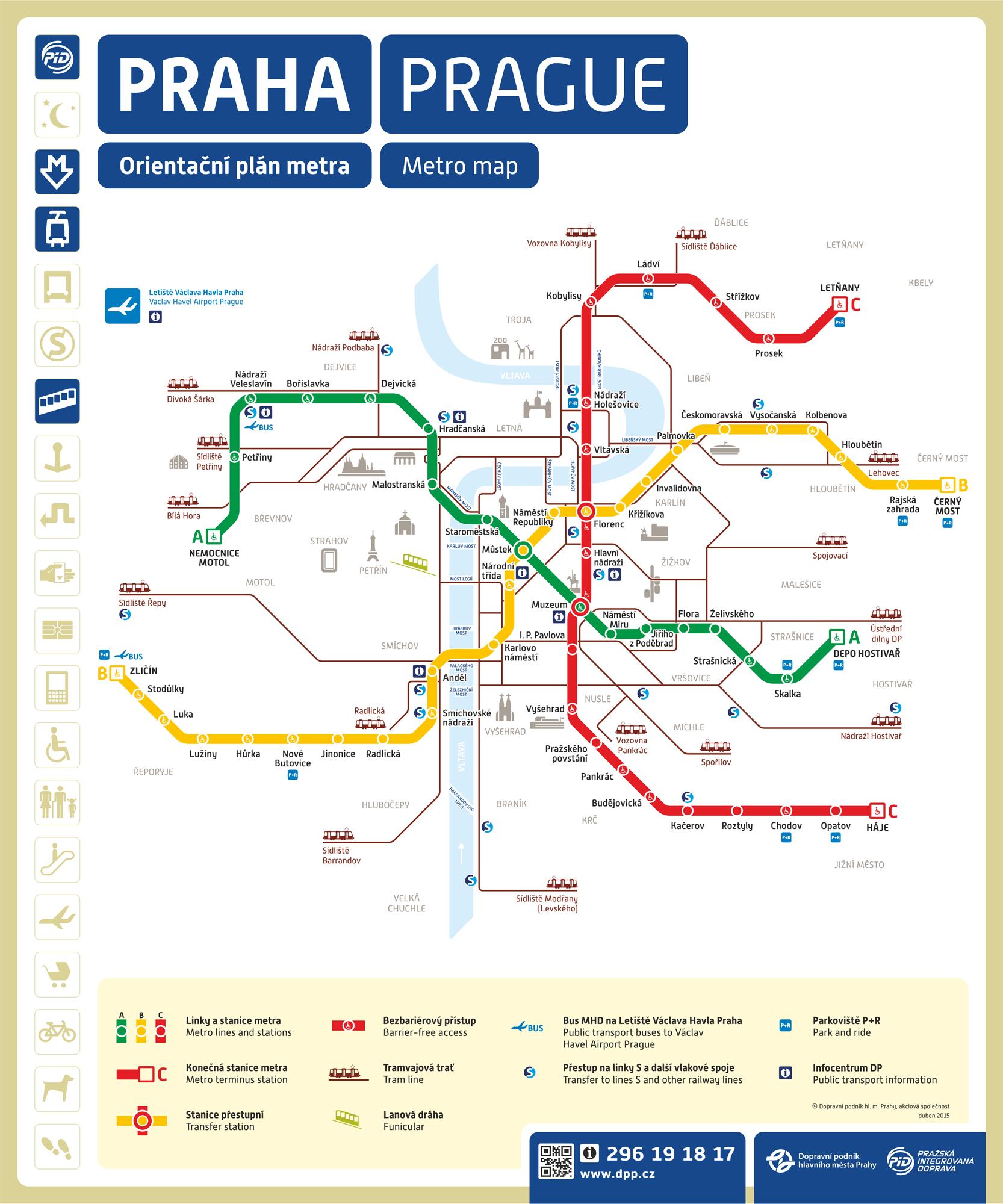
The map of the Prague metro shows Line A (Green). This Prague metro line runs through Prague from Nemocnice Motol to Depo Hostivař. The most important stations starting from the west are:
- Nádraží Veleslavín: Correspondence with the bus stop 119.
- Malostranská: nearest station to Malá Strana.
- Staroměstská: 5 minutes from the Old Town Square and the Jewish Quarter.
- Můstek: Correspondence with line B (yellow).
- Muzeum: Correspondence with line C (red).
Thanks to this map of the Prague Metro, you will easily travel around Prague. With the Prague metro map you will find the best way to reach the airport, trams and buses. The metro system in Prague is one of the best in the world because the Prague metro works perfectly. This map of the Prague metro is free and downloadable.
The metro in Prague map covers all areas of the city centre, and extends some distance into the suburbs. The prague metro operates 05:00-24:00. Metro lines run a service every 2-3 minutes during peak times, every 4-9 minutes after 19:00. There are 3 metro lines: A (green), B (yellow), C (red). The Prague Metro is safe and reliable, with trains running at high speed from one side of the city to the other.