
search
Prague tram map
Prague tram map english. Prague tram map (Bohemia - Czechia) to print. Prague tram map (Bohemia - Czechia) to download. The Prague tram network has 142 kilometers of track, with 22 lines in service during the day and 9 lines at night. The first trams were put into service in Prague on September 23, 1875. At first, the trams were pulled by horses. The first power line of the Prague tram was inaugurated in 1891. The map of the tram prague in English is available.
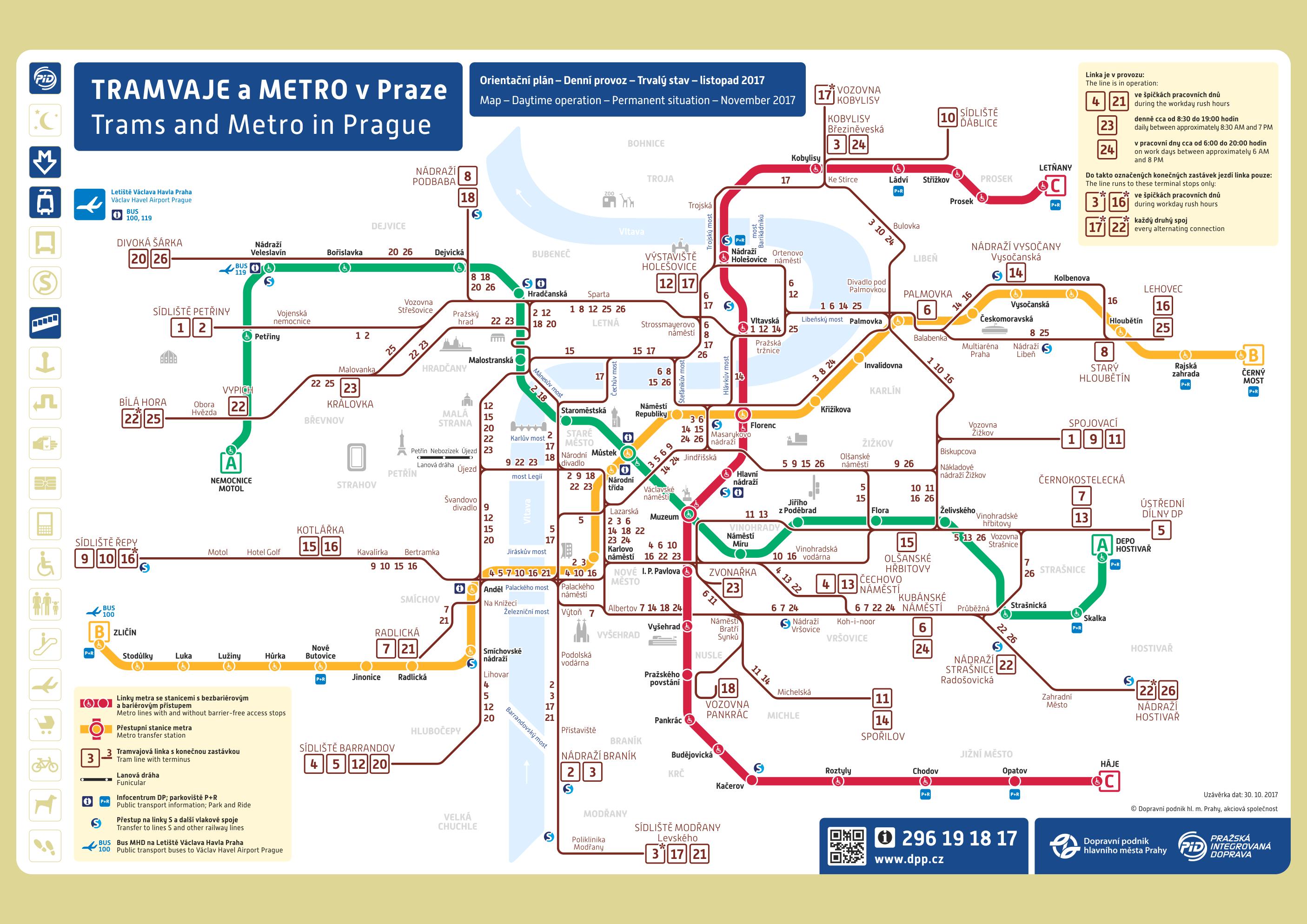
With the Prague tram map, you can have access to the city of Prague and places where the bus can not pass. The Prague tram network operates during the day and also at night.
Map of the Prague night tram: From midnight to 4: 30 pm, there are lines 51 to 59. The central exchange point of all Prague night trams is the Lazarska station.
The tram of Prague map is one of the most picturesque, fastest and most enjoyable means of transport in the center of Prague. Prague tram times are available at all stops. You can download the map of the Prague tramway in pdf. Some historic lines allow you to discover Prague without leaving its seat: line 23 and 41.
Prague network covers all areas of the city centre, and extends some distance into the suburbs of Prague tram map. Daytime prague trams operate 04:30-24:00. The most popular trams run every 4 minutes. Other trams run every 8-10 minutes during the week, every 8-15 minutes at weekends. Night trams in prague operate 24:00-04:30 and run every 30 minutes.