search
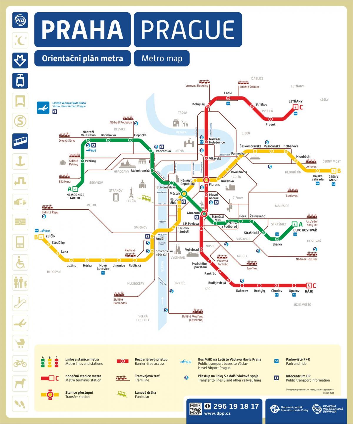
Prague metro station map
Andel metro station prague map. Prague metro station map (Bohemia - Czechia) to print. Prague metro station map (Bohemia - Czechia) to download. The prague metro line A (Green) crosses Prague from northwest to southeast, from Nemocnice Motol to Depo Hostivař. The most important stations in prague metro station map starting from the west are : Nádraží Veleslavín: This station leaves you at the bus stop of bus 119 to the airport, Malostranská: This is the closest station to Malá Strana. It is also useful to take prague tram 22 which leads to Hradčany and Staroměstská: 5 minutes from the Old Town Square and the Jewish Quarter.
Prague metro line B (Yellow) runs through Prague from northeast to southwest, from Černý Most to Zličín. The most important stations in prague metro station map starting from the north are : Florenc: Prague most important bus station and Náměstí Republiky: Next to the Municipal House and the Powder Tower. Můstek : Station north of Wenceslas Square. Correspondence with line A (green). Zličín : Arrival point of bus 100 from the airport.


