search
Prague public transport map
Prague transport map. Prague public transport map (Bohemia - Czechia) to print. Prague public transport map (Bohemia - Czechia) to download. In Prague, the public transport means used are the metro, the tram and the bus. The map of Prague public transport is available on this page. It is also possible to take river shuttles, which cross the Vltava River, the funicular that climbs to Petřín Hill and some train lines. The transport map Prague shows the connections between the different means of transport.
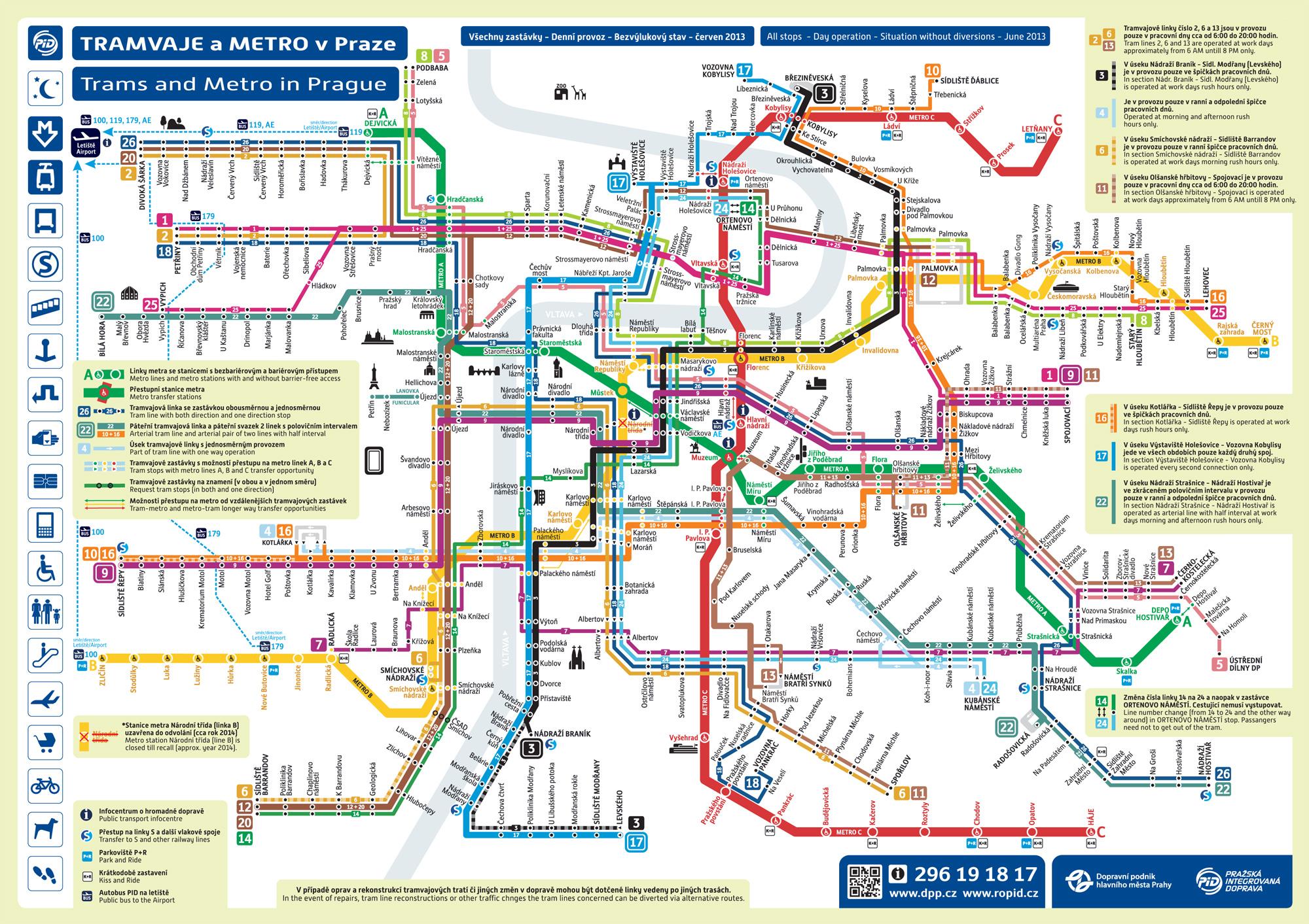
To use public transport in Prague the transport map of Prague is useful. If you want to explore a park, neighborhood or space a bit further, you will need to take a tram or a bus from Prague. Rest assured, it is very simple to travel to Prague by public transport and especially with the map of public transport in Prague.
Whether you spend a weekend or a few months in Prague, you will use public transport in the city. Multiple and very efficient system, you will easily reach the monuments and the many places that make Prague a dream destination. The public transport map of Prague will be very convenient. The Prague metro has 3 lines forming a triangle in the city center.